Day 43:Across the Mississippi River


April 8, 2016

New Roads, LA to Amite, LA

Day: 76.8 miles; Total: 2,333.2 miles

Elevation Gain: 2,850′

Map Link: https://ridewithgps.com/trips/8439634


Since we had arrived last night into New Roads with its waterfront setting at the end of a long day, this morning we got more of a chance to look at the nice historic downtown before we headed off. After about 10 miles of biking, we came to the beautiful Audubon bridge over the Mississippi River. Crossing it on busy but wide-shouldered 10,  it became clear that we would be climbing a bit out of the very low elevation where we’d been.

Shortly after crossing the river, we came upon a group of horsemen with both riders and wagons, as well as a school bus. Turns out they are a group of trail riders ( The Bayou State Riders) currently doing a week long ride in Louisiana. They were taking a break before going en masse down the highway to cross the big bridge. We commend their horsemanship for getting their horses so willing to go over the very busy bridge.

Our route then turned into a more rural road though dense forests and it passed by a site where James Audubon had spent some time doing some of his bird paintings. It was a beautiful area and we rolled up and down in nice dense forests.

The afternoon was spent heading due east on a fairly busy road with mostly good shoulders for us to ride on. Here in Amite , we got dinner at a very popular place specializing in catfish. Yum!

imageimageimageimageimageimageimageimageimageimageimage


Support Canine Companions for Independence.

Donate at our event page.

See details about our Southern Tier route.

Day 42:Louisiana Charm


April 7, 2016

Ville Platte, LA to New Roads, LA

Day: 101.7 miles; Total: 2,256.4 miles

Elevation Gain: 1,171′

Map Link: https://ridewithgps.com/trips/8428989


We knew this was going to be a long day so we headed out early and were fortunate to have nice weather all day; chilly this morning and warm but not too hot this afternoon.

After we biked out of town on the narrow residential road, it gradually turned to a lovely forested road leading past some fancy houses on the way towards the Chilcot State Park. There,  we wandered around on the bikes for a while taking photos and listening to the amazing bird sounds in the dense forests. At one point it sounded like howler monkeys and screaming panthers but we assume that they were all just bird calls.

Once out of the park, we were on a variety of mostly rural farms roads with all sorts of surfaces from great to incredibly bouncy and slow. We zigged and zagged following our map and several times when we were in what seemed like the middle of nowhere and were not sure of the next turn, we were helped by nice locals who stopped to offer directions. The route had us going north and at one point we were on a very quiet but very rough farm road next to a giant levee between the farms and an unseen river. We also crossed several big rivers, including riding over a large bridge across the Atchafalaya. ( good luck with the pronunciation of that one!)

At last we made it to our stopping point, along False River , and ate dinner at a waterfront restaurant overlooking the setting sun , watching some folks fishing in the quiet water. A very pretty sight…

image

The jumbo shrimp were being sold in the gas station!

image

image

Bill riding out onto a boardwalk in the park

image

A farmhouse along the way

image

We passed huge fields bordered by forests for most of the day

image

Some seriously big oaks

image

Ninety miles into the day, it was late afternoon and Traveler knew it was time for a real snack; this incredibly good homemade carrot cake and strong coffee. We were eating this in the cafe part of a gas station store. Apparently their food is famous, with reason!

image

Traveler meets Rob, an Army OEF ( Afghanistan) vet, and his son. He’s now a deputy sheriff and we had enjoyed getting to meet him .

image

Along the waterways 

image

image

Another handsome farmhouse 

image

A crop duster 

image

Sunset over the False River near our motel


Support Canine Companions for Independence.

Donate at our event page.

See details about our Southern Tier route.

Day 41: Crawfish and Rice


April 6, 2016

DeRidder, LA to Ville Platte, LA

Day: 77.5 miles; Total: 2,154.7 miles

Elevation Gain: 1,163′

Map Link: https://ridewithgps.com/trips/8417363

We started our day as we biked through the old downtown, looking at the DeRidder jailhouse where they incarcerated criminals who operated in this formerly neutral or so called ” no mans land” that was originally a disputed area not part of either Spanish Texas or the new Louisiana Purchase for about 15 years in the early 1800’s.

Then it was off to ride through more forests and grazing beef cattle, passing through several very small towns. Traffic levels varied and many of the huge trucks going by were carrying logs or wood products from the logs, like shavings and lumber. By the afternoon, we were seeing flooded rice fields and what turned out to be crawfish farms. Lots of birds like herons and egrets were hanging out in the flooded fields, probably looking for dinner.

At the end of the day, we walked next door to our motel to check out the seafood market. The nice folks inside explained what we’d been seeing with the rice fields that  get harvested, then flooded to farm the crawfish who eat the rice . They gave us a little guy to sample- yum, like a spicy little lobster!

Here are some photos of the day…

image

The old jail in DeRidder

image

The next door courthouse, currently in reconstruction 

image

Forests this morning 

image

Young cattle, including what looks like a Brahma calf with his little airplane ears

image

We saw all kinds of farm houses, including this that looks very southern to me

image

Greenery, water and grey clouds, that was today

image

The courthouse in Oberlin, where we stopped for our main midday break at a picnic table 

image

You can see the crawfish pots in the flooded field

image

Crossing a river

image

These pretty thistles are all along the road

image

Flooded field

image

Along the rural road this afternoon 

image

Typical view today

image

Because of the high water table, cemeteries are sort of above ground 

image

Checking out the local critters with the help of the very nice folks at the seafood market

imageimage


Support Canine Companions for Independence.

Donate at our event page.

See details about our Southern Tier route.

Day 40: Bienvenue en Louisiane and Traveler Says a Few Words…

April 5, 2016

Silsbee, TX to DeRidder, LA

Day: 76 miles; Total: 2,077.2  miles

Elevation Gain: 1,216′

Map Link: https://ridewithgps.com/trips/8406521


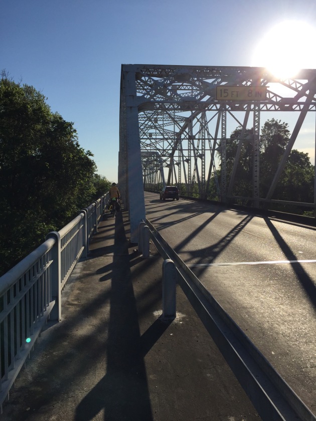
We got on the road early, riding into the bright eastern sun, past cattle and hay farms, rural homes and logging operations. We were excited to be heading to the border with Louisiana, not because we disliked Texas at all, but just because it has been such an amazing and huge piece of our trip!

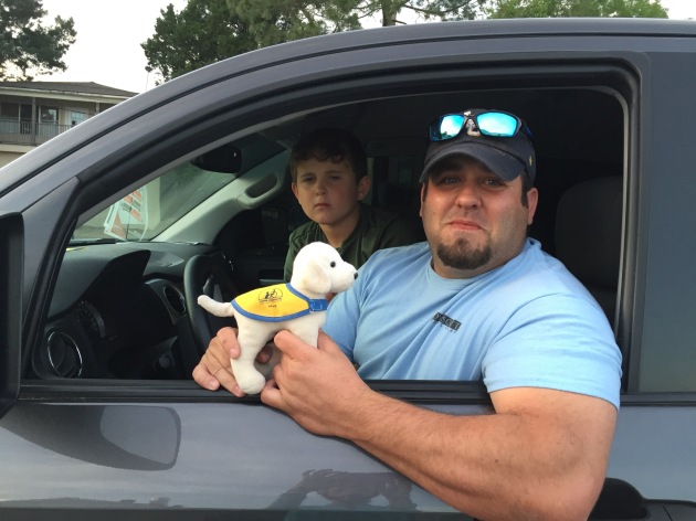
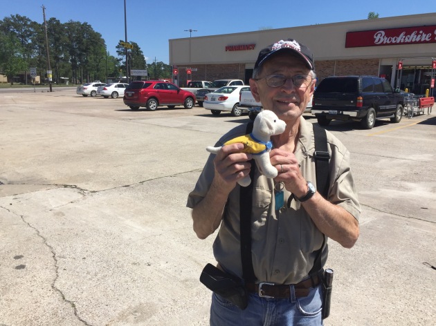
As we passed Evadale, Traveler gave a shoutout to Eva, our first CCI puppy, who became a Hearing Dog in 2012. Go Eva! Next, in Kirbyville where we stopped for water refills, we met Larry ( a Vietnam vet ) and his wife Burnett and they gave us some great tips for our time in Louisiana and we got to tell them about CCI and its Wounded Veteran program. A nice serendipitous stop!

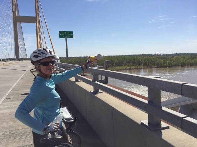
After a snack break in the unfortunately-named tiny road crossing called Bleakwood, we went on, heading to the Sabine River, the border here between Texas and Louisiana. We loved our time in Texas but it was quite exciting to know that our 950 miles there is complete. And…we’ve now biked 2077 miles of the Southern Tier and so that  is over the 2/3 mark for this trip. Progress!!

After an interesting stop in the county’s visitor center where we learned that pronunciation of local names will be an interesting challenge, we rode past mostly forests to our stop tonight, DeRidder.

And now Traveler, who has been pretty quiet so far, wants to add a few words…

Even though I spend my day riding in my Baggie strapped on Barb’s front left bag, I do get to see a lot. Here’s a bit about the daily routine: We all get up, pack the bike bags, with everything going into the same place all the time just to make it all easier each day. We eat at the motel if breakfast is offered, or grab something nearby if it’s not. Barb and Bill seem obsessed with their coffee so we some times hear grumbling if it’s not strong enough.

Depending on weather, road conditions and hills, we usually go for 2-3 hours and then  Barb usually wants a break to restock the tank and have a moment off the bike seat. We then continue on and will take other breaks as needed. Sometimes we stop for a real lunch, go inside out of the weather and then I get to meet people. That is my favorite thing, getting to have my picture taken with all the nice people we meet and Barb and Bill get a chance to talk to the a bit about Canine Companions and all the good their great dogs do. Sometimes we even meet other dogs but that doesn’t always work so well since usually they try to bite my head off! I’m not sure what it is about me…

When we finally get to the end of the day’s ride, we normally stay at a motel so I can have my own bathroom ( which is odd since I don’t ever “hurry” since I never eat or drink anything) but anyway…Barb and Bill take off of their bikes only what is needed to get cleaned up and wear their ” off the bike” clothes, then they shower, start selecting photos and then try to wrestle the local wifi and WordPress into getting the blog written. Barb says she’s very glad they are doing the blog because it both helps share with their readers the sights they are seeing, and it will help her wind blown brain recall the trip! I like the part where they share my pictures of all the people we’ve told about CCI.

Well, that’s about all I have to say now except, Whoopie! We’ve crossed another state line and also crossed the 2/3 point on this great trip!  Arf!


image

A river this morning leaving Silsbee 

image

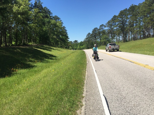
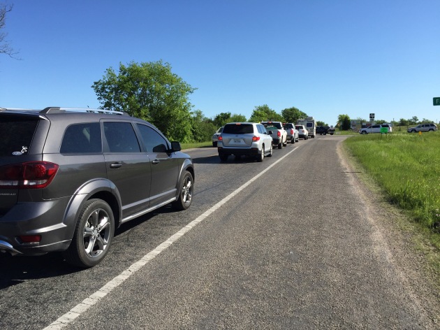
Our view for most of the morning: 90, with its nice wide and smooth (!) shoulder , a deep rumble strip and 75 mph speed limit 

image

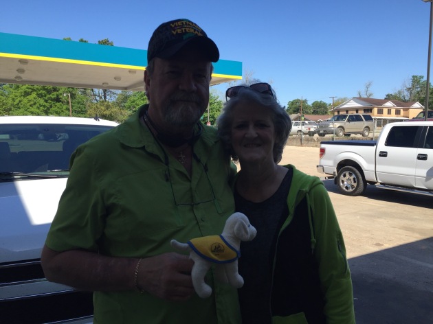
Traveler gets to meet Larry and Burnett

image

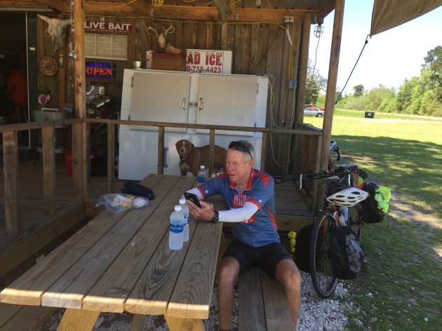
A snack break in Bleakwood 

image

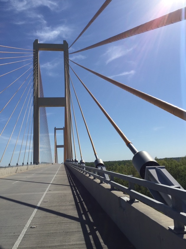
The Sabine River , with a flock of birds

image

Some new state signs
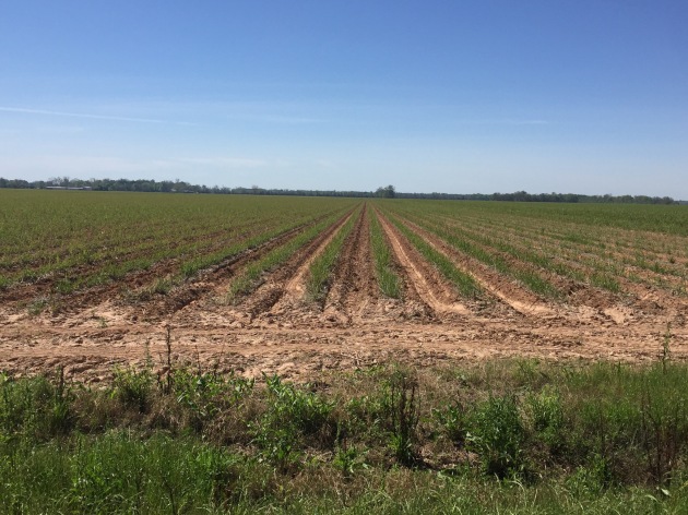
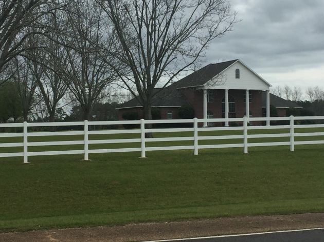
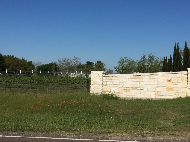
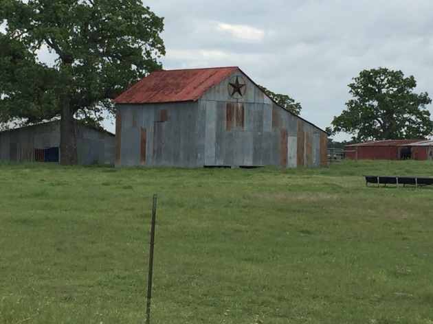
image

A Louisiana farm

image

Happy to see this border river!

image

Traveler makes another state crossing 


Support Canine Companions for Independence.

Donate at our event page.

See details about our Southern Tier route.

Day 39:The BigThicket


April 4, 2016

Shepherd, TX to Silsbee, TX

Day: 59.1 miles; Total: 2,001.2 miles

Elevation Gain: 938′

Map Link: https://ridewithgps.com/trips/8395447


Almost immediately after leaving the motel, we turned onto a rural road and began our basically flat day of riding through the trees. Everyone will say a road is flat ( as a car driver) but on a bike nothing normally is actually flat.  Today’s route had me primarily in my biggest front chain ring and that’s not usual on a loaded bike!

We biked past miles of forests and while there were logging trucks , they gave us a wide birth and the traffic volume and straight road kept the riding pleasant. There were several wilderness areas in the area but the big deal here is the Big Thicket Preserve. It was just south of our rural road and once consisted of more than a million acres of almost impenetrable forest boasting nearly every variety of hardwood and pine native to southern Texas. Extensive lumbering reduced the size of the forests so the area was protected as a preserve in the 60’s.

We stopped for lunch in the tiny town of Honey Island, where we ate at Pittman’s where you can get good food and your deer ” processed “.


image

Now this looks truly different from what we saw when we entered Texas 

image

The Trinity River, heading to its National Wildlife Refuge just to the south

image

The relatively quiet road kept these trucks not too scary

image

Traveler meets the nice folks at Pittman’s where we had lunch

image

Relaxing before we ate

image

Now here’s a motto to live by- ha!

image

Traveler meets Randy, in Kountze, who’s a local artist who bike toured in Texas in the 70’s. We encouraged him to go do it again!

image

You can see Traveler,near my left leg, securely riding in his baggie on my pannier 

image

A local who wanted to join us for lunch

image

Now this looks like the south!


Support Canine Companions for Independence.

Donate at our event page.

See details about our Southern Tier route.

Day 38 Photos

image

A Texas vineyard!

image

Along the road, with other cyclists 

image

Traveler meets Scott and Janice, on a training ride for the BPMS 150 , Houston to Austin 

image

Here come the trees

image

Traveler next meets Dana, triathlon coach who runs an extensive program in a local area known as the Woodlands

image

Very nice scenery 

image

Traveler meets Renee, of the Punkin General store and Big Woods Guns in Punkin, and her puppy

image

A novel ranch sign

image

We saw several homes like this in the Big Creek area

image

The dinner option at the end of the day, right across from our motel!

image

On the road

Day 38: Into the Woods


April 3, 2016

Navasota, TX to Shepherd, TX

Day: 78.8 miles; Total: 1,942.1 miles

Elevation Gain: 3,607′

Map Link: https://ridewithgps.com/trips/8385662


Another bright and sunny morning! We rode through rural farmlands and about 10 miles out, in the small town of Anderson, we encountered a number of road cyclists riding along the same route. Turns out there were some folks training for an upcoming MS ride from Houston to Austin ( that attracts 15,000 riders who spend the night at the fairgrounds in La Grange), and others were on a charity ride and even more were training for the Texas Ironman competition in about 6 weeks.

It was great to have others riding on the roads and it was a very nice day for being out on a bike. The farming areas gave way to pine forests as we entered the Sam Houston National Forest, and then several beautiful wooded state parks.

in the later part of the afternoon, we rode through an area called Big Creek Scenic Area with stands of tall pines, cattle in lush grass and the gently rolling road running through it all. Most of the towns we encountered today were very small, but at our several snack stops, we met some very interesting people and learned a bit about the area we were biking through. A fun day of biking as we try to take advantage of the good weather to make some eastward tracks!

Unfortunately the photos are not wanting to get into this blog, so we’ll get them in when the wifi is more cooperative…

imageimageimageimageimage

Support Canine Companions for Independence.

Donate at our event page.

See details about our Southern Tier route.

Day 37: A Texas-sized Antique Show


April 2, 2016

Lagrange, TX to Navasota, TX

Day: 73.2 miles; Total: 1,863.3 miles

Elevation Gain: 3,902′

Map Link: https://ridewithgps.com/trips/8370450


This morning was bright and cool as we rode across the river into the main part of La Grange to have breakfast at the yummy local cafe. Our route was primarily on small two lane rural roads through farm country. We’d been warned that currently this area is host to a really big antique show, or maybe a series of shows, but we didn’t think too much about it. Silly us…

There was pretty steady traffic flying alongside us and then as the road climbed up, we could see all the cars in the lane next to our puny road shoulder were stopped as far as the eye could see. We slowly rode along, now passing all the cars as we rode on the narrow shoulder, for several miles. At one point, a gal had gotten out of a car on the passenger side, since they weren’t moving anyway, so as I came alongside, I asked her if there was a stoplight ahead, or a major accident over the hill.  She said that it was just the normal traffic headed to the antique show in the next town. That town was Round Top, 9 miles ahead of us, directly on our bike route and as it turns out, the epicenter for this month-long antique show that was ending today. Ack! This looked like a very long hair raising morning and our bike map didn’t show any other options without going way off course for our end point today.

Long story short, we escaped the bumper to bumper traffic by turning onto a perpendicular road, finding a very small and very scenic rural road that got us to Round Top past the throngs  headed in. We took photos of the miles of vendors, parking spots and BBQ places and continued on. As we were leaving  the town ( population 80 by the way!), on the incoming lane, cars were lined up heading into town for another 6 miles. This 40 year old show definitely draws what looked like half of Texas!

After a stop at a nice cafe in scenic Burton, we headed out to ride all afternoon on very bucolic, much quieter farm roads. Really pretty riding among the wild flowers and well-fed cattle enjoying the lush grass.

Tonight, we are in Navasota and we had the pleasure of getting together with Bill’s cousin Brian and his wife Judy for dinner. Traveler makes new friends!


image

La Grange City Hall

image

Antiquers on the road

image

Rural countryside 

image

Antiques

image

The flowers were great in today’s bright sun

image

I liked this house

image

This estate was very striking 

image

Crossing a bridge this morning 

image

The shoulder widened where the road we soon escaped onto came in from the right. I felt sorry for those cars turning in to join the crazy line up!

image

Traveler meets Brian and Judy

image

We’ve been on this Independence route for a few days. The towns have names like Washington, Independence, William Penn, etc


Support Canine Companions for Independence.

Donate at our event page.

See details about our Southern Tier route.

Day 36: On the Road Again


April 1, 2016

Austin, TX to Lagrange, TX

Day: 78 miles; Total: 1,790.1 miles

Elevation Gain: 3,568′

Map Link:  https://ridewithgps.com/trips/8356152


Since we’d been visiting the city that has streets named for Willie, and his statue is in various places, it was hard not to be thinking of his lyrics as we set off this morning, heading east once again. The forecast was for no rain and for gusting wind most in our faces, but we got some additional surprises as the day went on.

Our route had us revisiting some of the hip indie area of So Co and the we wound up and down hills in the outlying residential area to the south of the city. Traffic and roads weren’t too bad and for a while the going was pretty flat through small farms.

We’d noticed some dark clouds to our right, then heard thunder and suddenly, the skies opened up and rain then hail descended. With the thunder and lightening, and the pouring rain and hail, we pulled off the road to wait it out. When it let up, we continued on, kind of drying out once the rain was over.

About midday, the route took us into two adjacent state parks, with very quiet ( and very hilly ) roads. The first one, Bastrop State park, has stands of unique pines that were severely impacted by the fires in this area in 2011.  As we rode along, the road dropped and rose sharply as we passed acres of these burned remnants of the forests. We then connected with the adjoining Buescher park and continued on the hilly, quiet road. We met a hiker who was braving the rain that had now been falling since we first entered the park. In a small world coincidence, it turns out that she grew up in the same area in California where I did. She has lived in this area since the 70’s but unfortunately lost her house here in the fire and so in now living in Austin. She described how beautiful the trees in the park had been before the fire.

We worked away at getting through the parks and then were on a small highway going past pretty farms, before turning south ( now finally with a tailwind- yay!) and rode the last miles to La Grange. This is a farming town, and they are familiar with seeing cyclists coming through, either doing things like the Southern Tier, or rides like an MS ride that draws thousands of cyclists for a 150 mile supported tour in the area. That ride has been happening here for 30 years!

Our motel is a cute, modest place near the center of town and we were greeted with cold water and an orange for each of us when we checked in; a very nice welcome. The owner had a notebook where we signed in with our biking destination and clearly he’s had guests doing this from all over. We ate dinner at a small local cafe which was bustling with diners who all seemed to know each other and enjoyed good food that helped get rid of the rain soaked chill from biking all day in dank clothes.

We only took photos sporadically because of the rain, but here’s some of what we saw…

image

Saying goodbye to Mary and Tim this morning. We had a great time with them in Austin!

image

One of the rural roads this morning 

image

Heading into the first park

image

In an area of the park not burned 

image

Finally! Another in the barn series

image

The local church in Winchester, a very small town 

image

A Texas farm, complete with oil rig


Support Canine Companions for Independence.

Donate at our event page.

See details about our Southern Tier route.

Days 34 and 35:Off the Bikes in Austin

Yesterday and today we have been being tourists in Austin. Yesterday, we toured, among other things, the state capital building, the historic Driskill Hotel, the LBJ Presidential Library, the downtown and Sixth St. neighborhoods and the “So Co” ( south Congress) neighborhood.

We had fun getting together with family here and got to meet Maeve, an Austin Puppy Raiser, and her puppy Hanalei. Thank you all!

Errands got done, we really enjoyed seeing Austin and got to eat some great Texas food! Tonight we went to see Esther’s Follies, a very funny comedy, music and magic review that lives up to the motto of ” keeping Austin weird”. Very , very entertaining.


image

The Driskill Hotel 

image

Local color inside the hotel 

image

Traveler looks at the state capital building 

image

Looking up inside at the capital dome, which is taller that the US capital building

image

Inside the Johnson Library


image

The Ladybird Johnson Wildflower Center 

image

With LBJ at the Library 

image

We had a fun lunch with second cousins Alison and John, Austin locals, at the yummy Torchy’s Tacos.


image

We met Austin puppy raiser Maeve, and Hanalei who looks interested in meeting Traveler 

image

Maeve and Hanalei with Mary and Tim, Bill’s sister and brother in law, who came from Seattle to join us in Austin. They are good friends of Traveler and CCI 

image

We all really enjoyed Esther’s Follies, and Traveler checks out the program. It’s a bit like SF’s Beach Blanket Babylon set in Texas. Very clever!